Pages

Showing posts with label Maps. Show all posts

Thursday, 17 November 2022

Cheshire Railways: Third Stop - Maps and Plans

"A map says to you. Read me carefully, follow me closely, doubt me not… I am the earth in the palm of your hand."
If this quote from aviator and adventurer Beryl Markham is to be true, then Cheshire Archives holds huge swathes of Cheshire’s earth, and beyond, in the hundreds of maps and plans in our railway collection. Plans of tracks, stations, bridges, tunnels, foot bridges, signalling, derailments, engine sheds, schools, goods yards, waiting rooms, lines that were built, lines that were never built - even the Station Master’s bathroom in Bebington. 

Over the last few years lots of work has been carried out to list, organise and repackage these plans to make them available for the public to view. So join us in this exploration of Cheshire’s railways and hold the earth, or at least some of it, in the palm of your hand.

First stop - understanding the plans

For some of the plans it is clear why they were made and what they are trying to show. The plans of Runcorn Bridge, for instance, are easy to understand. They show the bridge from various angles and different sections and elevations, and it doesn’t require knowledge of railway engineering to appreciate them. 

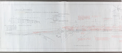
Other plans are more complex. The estate plans of lines with lots of handwritten annotations are difficult to understand. Was the line built, or not? What is the date? Sometimes a date is clearly stamped, but it is obvious that these were working plans and the annotations were added over years or even decades. But take from them what you can. The estate plans are full of wonderful details outlining ownership of parcels of land adjacent to the lines. They can include details that may not be found between census records, Ordnance Survey maps or other well-used family and local history records. 

The plans were made for many different reasons.  Some reasons are clear - such as to plan the construction of a bridge or the planning of a railway line - but for other plans it is less clear what the purpose is for. In listing and organising the collection, we have tried to make it clear on our catalogue what information can be taken from them - even when the purpose of the plan is less clear. As with all archives, the information contained within them can far exceed the purpose for which it was captured.

Second stop - understanding the types of plans

Firstly, there are plans that were created by the Engineering Department. These include buildings such as stations, waiting rooms, engineering sheds and goods yards. They show what the building would have looked like externally and internally - often in great detail. They show measurements and exist in various scales. Sometimes they show the area around the building and its location in relation to the wider station plan. 


There are plans of bridges, tunnels, culverts and viaducts. These are very similar in detail to the plans of the buildings, but often include mile points that indicate their position on the railway line. Engineering plans also include inspection sketches and signalling with details of alterations to tracks, signalling, sidings and junctions. There are also many more varied plans of engineering works such as drainage, line widening, and track plans.


The second series of records are those created by the Estate Department. These are more complex and can be difficult to understand. They largely consist of plans showing the full line or a section of a line. In their most basic sense, they show the routes and the land around them. They are full of details such who owned the land adjacent to the line. This is great if you are researching a nearby property or piece of land, especially if no other mapping exists for that point in time. 

The plans are drawn to various scales but the most common are the 2 chains to 1 inch surveys (1 chain=22 yards). They can be individual plans of a section of a line, or can be many plans bound together in large unwieldly volumes. They are often annotated with details that sometimes can be easy to understand or sometimes complex and technical. They are often stamped with details of different railway companies and have clearly been used over many years. They have been listed on our catalogue with the start and end point of the line, with details in the description of the stations in between which are featured.

Third stop - understanding the scope

The lines didn’t stop at county boundaries and neither do the railway plans. As such, it follows that a lot of the plans go beyond the scope of Cheshire. There are many plans for neighbouring counties but also many from much further afield including lines in Ireland and Wales. The plans are listed in good detail on our catalogue, so a search for the place of interest should be easily found.


Final destination - the catalogue

The plans on our online catalogue are arranged under three sections; engineering plans, estate plans, and deposited parliamentary plans. The deposited parliamentary plans are a shorter series and compliment those deposited plans in our Quarter Session records (see QDP). Within each section they are sub-divided into types of plans such as ‘stations and buildings’, ‘line sections’ etc. Within each series they are listed alphabetically by place. A further guide is in progress that will allow researchers to identify which line a station or structure sat on and if we hold plans. Watch this space for further details on this.

The railways covered a lot of earth and the plans cover a large portion of this. Search our catalogue to discover the full extent and arrange a visit to the Record Office to hold them in the palm of your hand.


All of these items are available to view at Cheshire Record Office in Chester.  Part 1 of this blog is First Stop - The History and Part 2 is Second Stop - Employee Records.  

Friday, 26 February 2021

A Pub in Parkgate

Would you like to learn more about a local business or building from the comfort of your own home? This blog will take you through some of our online resources using the example of The Boat House, a pub in Parkgate at the end of The Parade.

Our first port of call is the Cheshire Tithe Maps website, available through the Cheshire Archives and Local Studies website. Cheshire Tithe Maps Online allows you to view and search almost 500 tithe maps and compare these alongside other historic mapping. Together with the information recorded in tithe apportionments, they are a unique record of land ownership, occupancy and use in Cheshire 150 years ago. The video clip below talks you through how to use the website for your research. 


The tithe maps website will also allow you to search by person or by plot, if you wanted to see what else was owned by the Mostyn family for example.

To delve deeper into this website please see our previous blog You are here! But who was before? Discover history on your doorstep using Cheshire Tithe Maps Online.

Now let’s see what we can find using the digitised trade directories available to view and search online via our website. Trade directories were the Yellow Pages of their day, produced from the 17th century onwards to meet an increased demand for information on commerce and industry. This video shows you where to find them and how we can use them in our research.


If you are interested in carrying out research into the history of the Johnson family using census records, then you can use your Cheshire library card to access the Ancestry website from your own device at home. Full free access is available at your local library, and at the record office itself. For more information on using Ancestry Library Edition, why not check out our beginner’s guide on our YouTube channel?

Next, using the Neston Borough Building Control Plans Database which is also available on our website, we can search for any information relevant to the Boat House, or the Pengwern Arms, between the years 1868 and 1950.


Lastly, let's visit the Cheshire Image Bank to see if any images of the Boat House have been digitised and available to view online.

The image bank is available through our website. We continually digitise and add new images to this online collection, bringing together pictures of Cheshire’s people, places and events, and we currently have nearly 31,000 images available online.

A search for “Parkgate” in the top right search box brings up 138 results, including several which will be of interest in our research, or you can follow the steps demonstrated in the below video clip.


If you were interested in obtaining a digital copy of an image, please click on “How to Obtain Prints” on the left-hand menu.


You may also like to visit our Flickr page, where we have further material digitised and grouped into albums.

We have now learned more about the history of The Boat House without even leaving our sofa! We have been able to find images of the pub, the names of its publicans and know that it stood on land owned by the Mostyn family. We know alterations were made over the years, that its name changed, and we have found its location on 19th century tithe and ordnance survey maps. Why not explore our online resources yourself, travel back in time and see what you can find out about your local area?! Keep curious!

Wednesday, 27 May 2020

A Conservator's Blog


Being a bit of a technophobe not having a PC or broadband was never really a problem; mobile phone reception was problematic and occasionally warranted running up the lane to the second oak tree on the right and waving my phone wildly about. But when lockdown was announced I did wonder if I’d made the right decision in being so unconnected with the outside world. How was I going to get any work done? All the other Record Office staff were able to work from home online.  Luckily I had a few days to think about it as I was on leave that week.

Being a conservator I decided that I’d conserve (if my manager agreed to it and luckily she did!), but what? I was limited to what materials and equipment I could take home, so it needed to be fairly simple. Also, what could I work on? Taking unique and valuable documents out of the safety of the Record Office would not be right. Second edition Ordnance Survey maps (25 inch) were the answer.  They are not unique and have no real financial value but they are often consulted in the searchroom and a very useful resource. The first and third editions have already been conserved as these were the most often looked at, but there were still a considerable number of second edition maps that were dirty, tatty, torn and creased with odd areas missing and in need of conservation. This I could do at home, although the encapsulation of the maps (custom made protective sleeves made of clear, inert polyester film) would have to wait till lockdown ended.

Close-up of a 2nd edition Ordnance Survey map.

Setting up a makeshift conservation studio was the next challenge. I’d decided upon the back sitting room which had plenty of light and space.  I’d moved house the previous summer and this room was still very much a work in progress. Bifolding doors had been put in, but there was still plenty of bare plaster and I’d been using the room as storage for boxes and furniture.  The remaining days of my leave were spent decorating, cleaning and tidying. The dining room table was utilised as my work table (for cleaning) and an old desk was used to do the repairs on.  I repainted on old cupboard which was to be used for storing materials and equipment. The O.S. maps are large objects (measuring approximately 1.05m x 0.72m) and I needed space to store the maps when I wasn’t working on them.  A redundant door (I’d just had a doorway bricked up) was employed as a makeshift table which was propped up by three dining room chairs – conservators are nothing if not resourceful!

My home conservation studio was soon up and running and working pretty well.

Faddiley annex of Cheshire Record Office.

As a conservator one of my duties at the Record Office was once a week to monitor and record the environmental conditions in each of the seven strongrooms, this still needed to be done. As I have a car I drive to the office once a week to check on the strongrooms, catch up on emails and check on the post. While I’m there I pick up a batch of O.S. maps to take home and bring back the ones I’ve conserved. I also cook up fresh paste once a fortnight as it soon starts going mouldy and needs to be kept in the fridge.

I love looking at maps, even O.S. maps from 1898. While I’m cleaning the maps my mind starts wandering and I wonder how the areas have changed over the past 120 years. I really wish I had the internet to look at our tithe map website, which not only shows all the tithe maps we hold, but all three editions of the 25 inch O.S. maps, aerial photographs and a current map. It’s a fantastic resource, you are able to zoom in and out of the maps and compare two different maps of the same areas. It also gives you such details as field names, owners/occupiers and land use. On thinking, it’s probably a good thing I don’t have the internet as I’d spend way too much time looking at the website each time I worked on a new map.  

Some of the names of buildings and places spark my interest, such as ‘Black Jane’s farm’ near Daresbury, who was Black Jane? And who ever lived at ‘Hades Nook’ (near Whitley)? I love the descriptive names such as ‘Thatched House Farm’, does the farm still exist and is it still thatched?  And the slightly surreal ‘Waterless Bridge’ (near Tabley) which goes over ‘Waterless Brook’, does it have any water in it? The tithe map website might just have the answer. 

Cleaning maps is a relatively simple technique and involves using a pure vinyl eraser which you rub over the surface of the map. Care, skill and experience is required in order not to leave any dirty streaks or create or worsen tears. Any pencil annotations have to be carefully cleaned around, a slip of the eraser and the pencil marks would soon be lost. Removal of surface dirt is necessary as dirt is not only visually distracting, but can be harmful to the map; it can be abrasive, acidic; act as food for insects and for mould to grow on.


Once cleaned the maps are repaired. Tears are repaired with a strong acid free lens on the back or, in professional speak, verso and a finer, transparent Japanese Kozo tissue (made from the fibres of the mulberry tree) on the front or recto. The tissue is cut out with a mattress needle and pasted down with a pure wheat starch paste; the tissue is smoothed down with a Teflon bone folder and pieces of paper maker’s felts and boards are place over the repair with a weight placed on top until the repair is dry.  Missing areas are filled in with a heavy weight, long fibred Japanese paper called Bunkoshi which has a similar colour, weight and texture as the original map paper. The repair paper is shaped to the missing area with a rotring pen filled with water. Once dry the repairs are trimmed to the size of the map.

Tools of the trade.

What am I enjoying working at home? Watching the garden birds, I can see the bird feeder from my work room and love watching the male pheasant strutting through the garden. My greenhouse – for a break I’ll take my mug of tea out there to see what has germinated and which bulbs are coming through; the plants are getting very well looked after at the moment. Getting to know my lovely neighbour, sometimes my morning break consists of talking to her over the garden fence mug in hand (and at a safe social distance).

Fezzy the tame pheasant on top of the hedge.

What am I missing? The staff, especially fellow conservator Angela, who, after over 10 years of working together is a good friend as well as colleague; not having the internet makes you feel more isolated from everyone. Cake, the staff tearoom is always well endowed with cake and biscuits kindly supplied by staff and searchers.

Excitement – it was silage week last week, the quiet lane was turned into a scene from wacky races with many tractors and trailers going up and down, and the fields change by the minute. Unfortunately it’s muck spreading week this week.

Thanks – to Radio 4 for keeping me entertained and sane.

Working from home has been an enjoyable challenge and brings back memories of doing work experience here 27 years ago, when cleaning O.S. maps was my first task. So far I have cleaned and repaired 54 O.S. maps.  I have cleaned an area of 82.04 metres squared, which is the equivalent of a fifteenth of an Olympic sized swimming pool.  I am less than halfway through the maps still to be repaired, so I should be able to be kept busy if lockdown continues.