Pages

Tuesday, 28 February 2023

Historical thinking: using the census in primary teacher education

This blog is from a guest contributor. It is based on an article written by Tony Pickford, Visiting Lecturer in the School of Education at the University of Chester, about using the Census in primary education.


Local History is a required area of study on the primary school curriculum. When educating would-be teachers, I have always encouraged them to empathise with historical characters and to try and think like them as well. A key resource in promoting this ‘historical thinking’ is the census. Site visits, images and written documents such as diaries all have potential for prompting ‘historical thinking’ - in teachers and older primary pupils alike - but census extracts provide a unique window into real lives and life experiences in the 19th and 20th centuries.

A census has been conducted in this country every ten years since 1801 (except 1941). The first only gathered population figures for villages or towns, but details of the members of each household were collected and recorded from 1841 onwards. In every census year, heads of households were instructed to complete forms giving details of everyone who slept in that dwelling on census night, which was usually a Sunday in March or April. The forms were collected a few days later by an enumerator, who entered the information into enumeration books.

For the period up to 1901, enumeration books recorded people’s place of birth, their age, occupations and relationships. In 1911, because of rising standards of literacy, forms completed by householders were retained for the first time. Accessing the pre-1911 records is now a relatively straightforward task: transcribed and digitised versions of the schedules are available via the online subscription services Ancestry and Findmypast, which are provided for free at Cheshire Record Office in Chester. Some transcripts of census records are also available free of charge on www.freeCEN.org.uk.

Younger primary children can find it difficult to read 19th century handwriting, and this is easily addressed via transcriptions mentioned above. But older children often enjoy the challenge of deciphering original documents. The authenticity provides a tangible link to the past and helps to foster ‘historical thinking’. To promote this principle further, I developed some census-based activities for students.


The first activity aimed to combine history and information technology. Students had to imagine a time machine bringing back an enumerator from the past to do a final check of the census. They had to ‘become’ the residents of a street and use census information held on a database to find information about ‘themselves’, such as their address, relationship in the household, occupation or place of birth. When the enumerator appeared (myself or a colleague wearing a Victorian top hat!) we would discuss what they had learned. It became clear that while this task and role-play was useful at demonstrating how to use a database, it was less useful at immersing students in the period and getting them to relate to the people in the census.

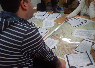
As a result, I changed the activity to include more immersive role-play to try and achieve the goal of ‘historical thinking’. We visited the streets listed in a chosen census and students had to identify buildings through photographs of features on buildings. Finding a suitable street was not a difficult prospect being based in Chester, with an abundance of streets built in the 18th and 19th centuries, and Cheshire Record Office has a searchable online database of local images (Cheshire Image Bank). This, with supplementary work like sketching buildings, or listing key words to describe the people who lived and worked there in the past, had a more positive outcome.


Back in the classroom, students were given copies of the census, and were surprised by the range of different households in the locality, and their inhabitants, that the census revealed. Alongside wealthy middle-class families with servants, there were boarding houses, public houses, small hotels and even a bank. Students were then given a key task that I hoped would lead to ‘historical thinking’: working in small groups to create a short conversation between the residents of ‘their’ property – a conversation that might be overheard by a passer-by and give some information about who lived there. We would discuss the type of language that would be used - words and expressions that would and would not have existed in 1901, for example - and strict instructions to avoid slang and expressions such as ‘okay’ and ‘yeah’!


We recorded these conversations and, after sharing them with the wider group, students were asked how they had approached the task. Had ‘historical thinking’ been used to underpin the conversations? The answer to this question was not simple.


Some conversations produced a great deal of information. Others conveyed individual characteristics with some humour (such as using an accent or imagined personality traits linked to a person’s profession) but gave little detail about relationships in the households. A few conversations suggested students had genuinely explored the views that characters might express – differing opinions about issues of the time that might arise in the households, for example. There were glimpses of ‘historical thinking’ - not enough to claim that the role-play had achieved its aim in full, but the conversations showed more engagement and immersion in the census material than the previous database activity. To that extent, this second activity was successful.

The session concluded with students translating the activity into a series of lessons for a chosen age-range of primary school pupils, and the audio files were shared on the University intranet. Overall, the second activity showed that census extracts, when supplemented with other sources like a visit to the houses and streets documented in that census, can provide the cognitive scaffolding that might support student teachers – and the children they are intending to teach – in ‘getting inside the head’ of people in the past.


Thank you to Tony Pickford for offering us his article.

Cheshire Archives and Local Studies published another blog about the census in 2022. ‘A “New” Census’ can be found here.


Tuesday, 14 February 2023

What Is Cheshire?

Cheshire Archives and Local Studies is one of hundreds of public record offices throughout the country, which carefully preserve and allow access to the historical archives of their local communities. These are often called “County Record Offices”, although in practice the areas they serve can be far smaller (or occasionally even bigger) than a county. Which raises the question… what is the county of Cheshire? Well, the answer depends on the date and the type of records you’re looking for. 

The “Cestrescire” recorded in the Domesday Book of 1086 was one of 34 ‘shires’ that the Saxons established in England and Wales well before the Norman Conquest. Its boundaries then appear to have extended into what later became south Lancashire and most of Flintshire. However, the boundaries of the shires remained fluid and continued to evolve over the next few centuries. 

From 1254 to 1545 the County Palatine of Chester had its own parliament, consisting of nobles from the county serving under the Earl of Chester. This was abolished by the Chester and Cheshire (Constituencies) Act 1542, and thereafter the county was represented at Westminster by two Knights of the Shire, while the city of Chester was separately represented by two burgesses. 

Speaking of the city of Chester, in 1238 this had been granted the status of a “county corporate”, effectively making it independent from the rest of Cheshire, with its own completely separate system of local government. This was officially styled as the City and County of Chester, to distinguish it from the County of Chester (referring to the rest of Cheshire). These potentially confusing descriptions could still be found in some official sources until as late as 1974. 


By the mid-16th century, Cheshire had assumed its familiar ‘teapot’ shape, with the Rivers Mersey and Tame marking its northern extent, and the River Dee delimiting most of its western boundary with Wales. This area is often referred to as the Ancient County of Cheshire, and it remained largely unchanged until the Victorian period, when new systems of local government were required to cope with the demands of an increasingly large and industrialised population. 

The Registration County of Cheshire was formed from groups of poor law unions set up in 1835, under which groups of parishes would combine to care for their poor and infirm residents. When a new civil registration system for births, marriages and deaths was established in July 1837, most of the poor law unions doubled as “registration districts”, with the poor-law overseers becoming local registrars. However, unions and registration districts didn’t always respect county boundaries, with the parishes of Hawarden (Flintshire), Biddulph (Staffordshire), and Heaton Norris and Reddish (both Lancashire) being included in Cheshire districts, while the Cheshire parishes of Disley, Mottram in Longdendale and Malpas were originally placed with districts in Derbyshire, Lancashire and Denbighshire respectively. When searching the national indexes for our ancestors’ births, marriage or death certificates, this can mislead us into disregarding entries which seem to be in the ‘wrong’ county. These boundary anomalies persisted until 1937. 

The Victorian period also saw the introduction of local boards of health, to improve conditions in the towns and cities. From 1872 these became “urban sanitary districts”, with the remaining parts of each poor law union becoming “rural sanitary districts”, and they gradually took on more and more responsibility for local affairs (the “sanitary” part of the name was dropped in 1894). Several of these districts inconveniently extended into two or more counties: for example, Stockport, Stalybridge, Warrington, Ashton under Lyne and Mossley, each of which comprised parts of Cheshire and Lancashire (with Mossley including parts of Yorkshire for good measure). To remedy this problem the Local Government Act 1888 created a system of Administrative Counties, by placing each district in the county where it had the largest population. Although the administrative county of Cheshire was a little smaller than the ancient county, it contained a larger population. 


Although the 1888 Act made it clear that administrative counties were intended to exist alongside (rather than replace) the ancient counties, the latter became increasingly redundant for purposes of local government, especially after a new system of county councils and county boroughs was established in 1889 by the same legislation. This meant that certain large towns and cities functioned as counties in their own right: in Cheshire these were Chester, Birkenhead and Stockport (joined later by Wallasey in 1913). 

This system of local government was swept away when the Non-Metropolitan County of Cheshire was created in April 1974. The urban areas on the Wirral peninsula, and to the south and west of Manchester were transferred to the new metropolitan counties of Merseyside and Greater Manchester respectively, while Cheshire gained the towns of Warrington and Widnes from Lancashire in compensation. All the county boroughs were abolished, with the city of Chester at the centre of one of eight new districts making up the county, all overseen by a reformed Cheshire County Council. 

In 1998, two of these districts, Halton and Warrington, became “Unitary Authorities”, granting them the powers of a county council. In 2009, the remaining parts of the county were divided into two more unitary authorities – Cheshire West and Chester, and Cheshire East – with the result that Cheshire County Council ceased to exist. However, Cheshire itself lives on as a Ceremonial County, established under the Lieutenancies Act 1997, now comprising the boroughs of Cheshire East, Cheshire West and Chester, Halton, and Warrington. 


We should also mention the Diocese of Chester, which at its foundation in 1541 extended as far north as Cumberland and Westmorland, taking in almost the whole of Lancashire, and parts of north east Wales. During the nineteenth century the area of the diocese was steadily reduced to roughly correspond to the ancient county of Cheshire, as it still remains to this day. 

Cheshire Archives holds records relating to all the Diocese of Chester and the former county authorities, although some collections for places outside present-day Cheshire have been transferred to neighbouring record offices – for examples, wills for Lancashire residents proved in the Diocese of Chester before 1858 are now at Lancashire Archives. So if you aren’t sure whether we have the records you need then please ask us before you visit, or consult our online catalogue and guides.